After releasing BIRDS-3 satellites, we took many photos and downloaded these ones. We would like to share with you the following photos that were taken by the BIRDS-3 satellites.
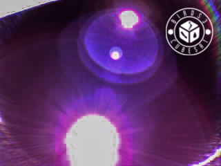
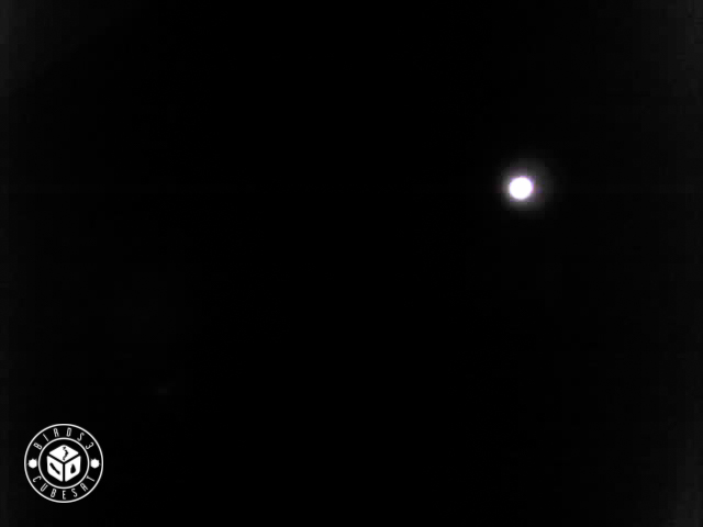
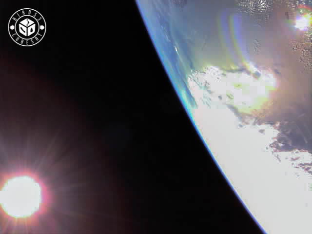
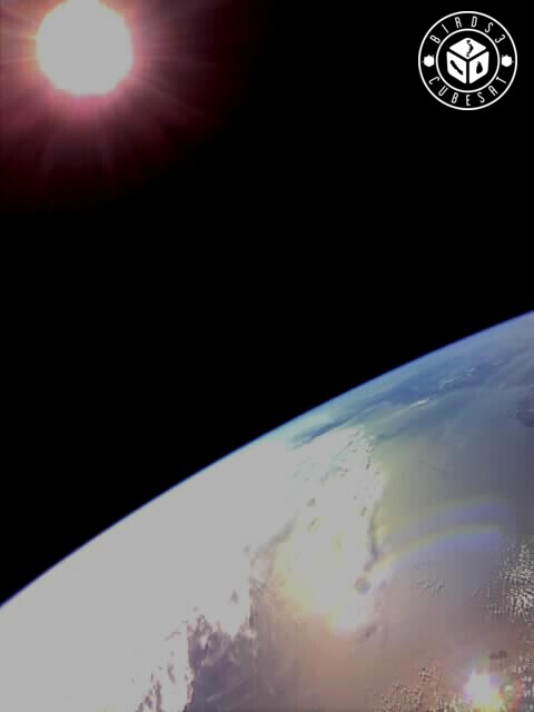
This is the first image taken by BIRDS-3 satellites. It is an image of the sun
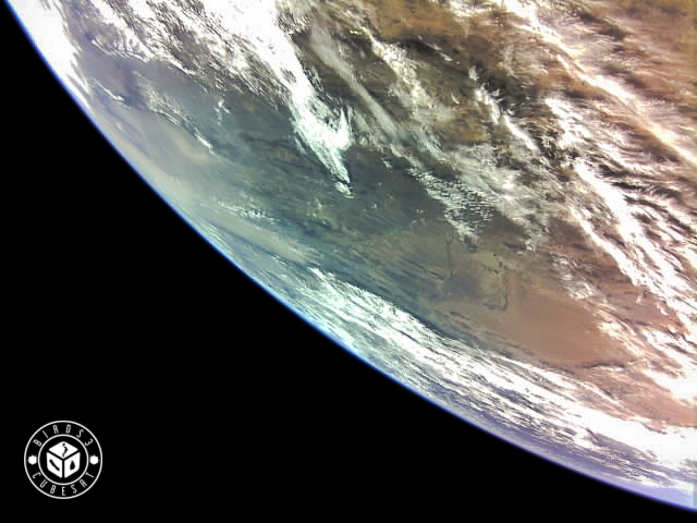
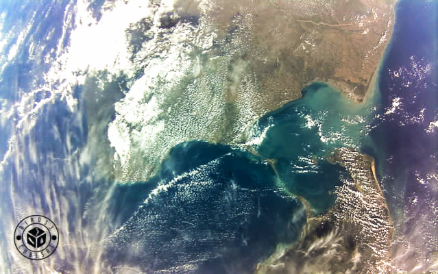
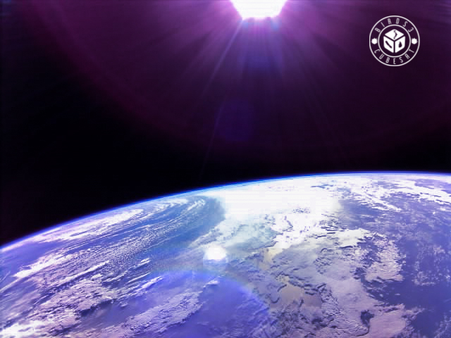
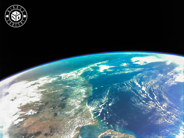
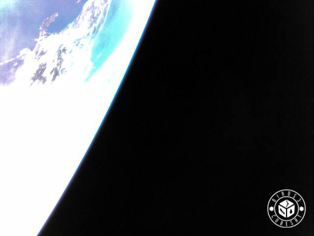
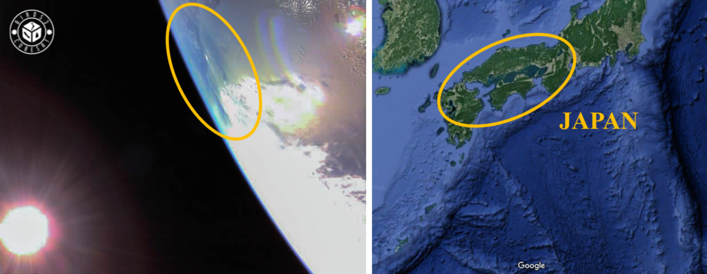
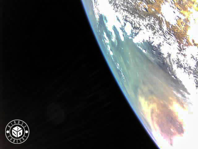
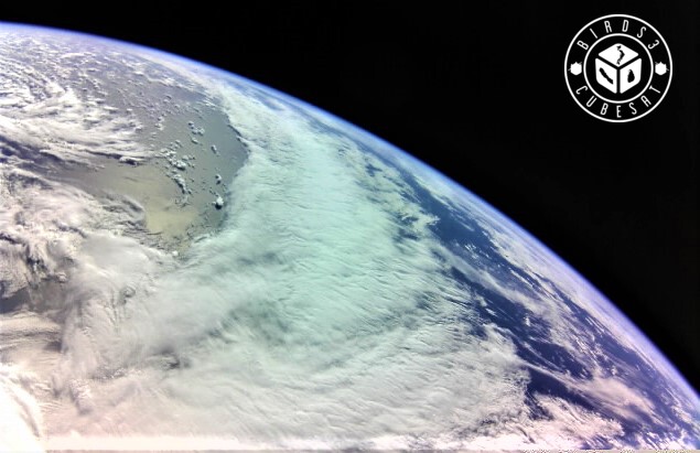
This photo was taken when the satellite was over Japan. It shows beautiful clouds and the horizon
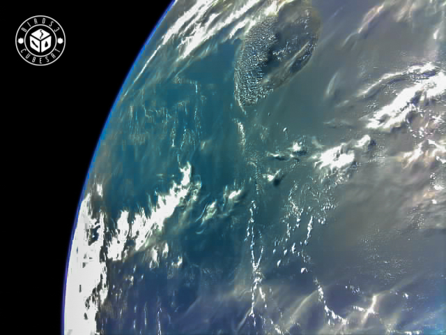
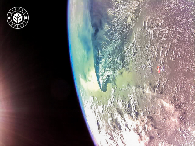
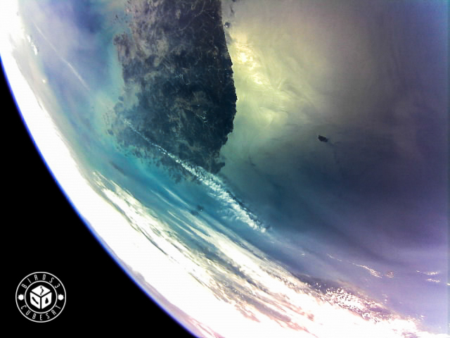
This photo shows south of Sri Lanka This photo was taken over Sri Lanka. This shows the beautiful Sri Lankan island surrounded by the blue ocean
Please acknowledge BIRDS-3 if you use these images. We will be delighted.
BIRDS-3 satellite takes a snapshot of Mongolia and it’s capital Ulaanbaatar. The command was sent from the National University of Mongolia (NUM) which is part of the BIRDS Ground Station Network. We appreciate the help and support of our friends there. – Update on September 27, 2019 –
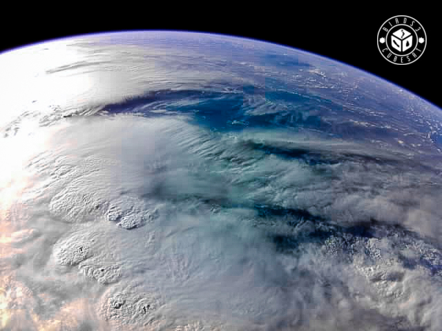
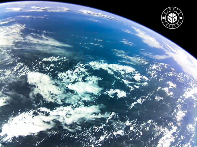
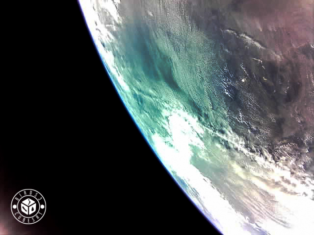
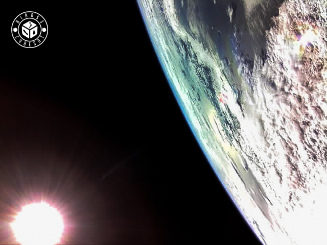
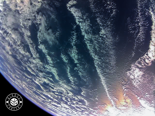
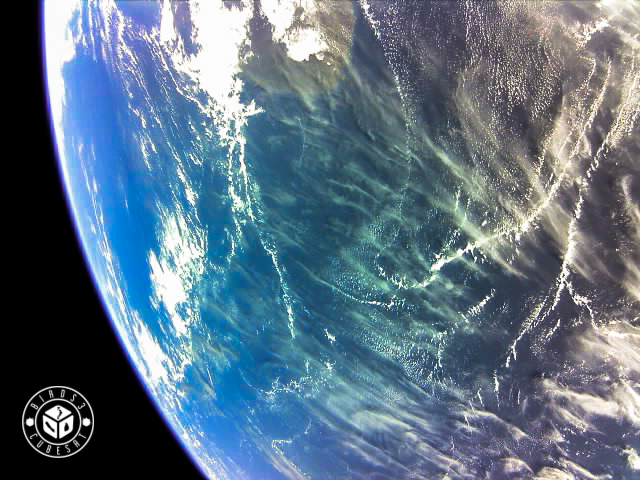
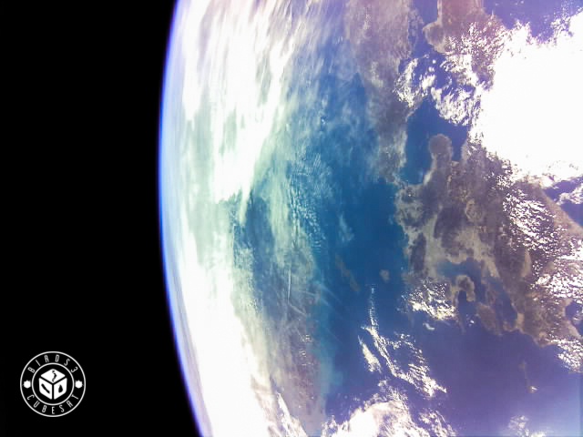
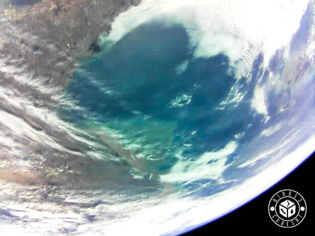
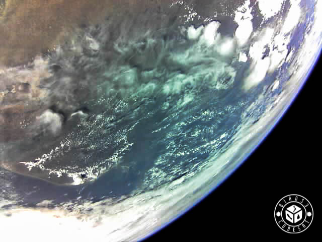
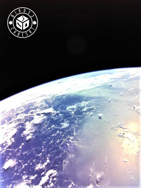
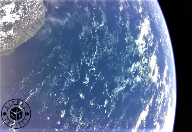
Our blue planet in the eyes of BIRDS-3 satellites. – Update on October 5, 2019 – BIRDS-3 satellites take a birds’ eye image over the heart of Sri Lanka island. – Update on October 12, 2019 –This photo was taken from Ghana, and their capital Accra is shown in this photo. – Update on December 21, 2019 –This photo is over the Pacific Ocean. It was taken from Kyutech Ground Station. – Updated on January 10, 2020 –It looks like the Yellow Sea near China and South Korea. Which part of the Earth do you think this photo? – Update on January 17, 2020 –We took this photo. We can see clouds and the ocean. There is a light spectrum of the sun. Can you see that? – Update on January 25, 2020 –We can see Sun and Earth in this photo. This photo was taken by BIRDS-3 satellite. – Update on February 8, 2020 –Here is the ocean, we are trying to capture Japan island but we always took the ocean photos. – Update on February 15, 2020 –We took the Indian Ocean by BIRDS-3 satellite. There are many Ocean photos now but the color of the Ocean is everything is different. – Update on February 21, 2020 –Raavana-1 was able to capture “The Palk Strait” (Tamil: பாக்கு நீரிணை, Sinhala: පෝක් සමුද්ර සන්ධිය) between Sri Lanka and India. In the picture, the ancient Adam’s bridge (also known as Rama’s Bridge or Rama Setu) is visible. It is a chain of shoals between Maanar Island (North west coast of Sri Lanka) and Rameswaram Island (South-eastern coast of Tamil Nadu, India). ~Some says this is a natural bridge. But this bridge was mentioned in Ramayana. According to Ramayana, it says Rama’s Varana army constructed this bridge to reach Sri Lanka. Science Channel Documentary: https://www.youtube.com/watch?v=odUtqDz4lEk – Update on February 28, 2020 –Uguisu was able to capture Japan. There are shown Kyushu and the parts of Honshu and Shikoku. There is “Kanmon Straits” between Honshu and Kyushu. In 1185, the battle of Dan-no-Ura occurred at Kanmon Straits. This battle was between Heike and Genji. Please see this website for the details: Yamaguchi JAPAN Travel Guide (http://www.visit-jy.com/en/spots/15266)
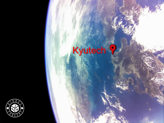
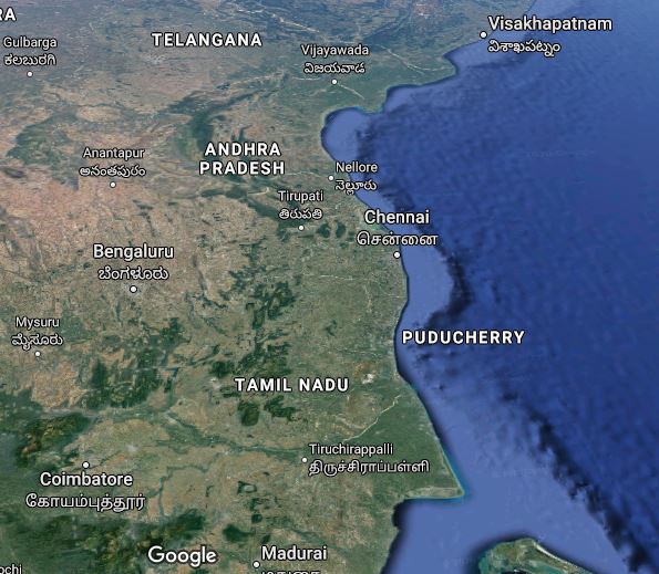
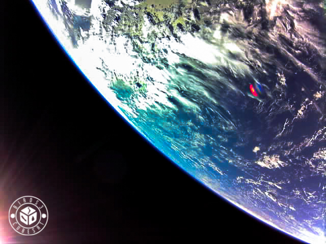
In Kyushu, there is Kyushu Institute of Technology (Kyutech), the position is below; We made BIRDS-3 satellites here. – Update on March 8, 2020 – Amami-Oshima, Tokunoshima, Yoronjima Island, Okinoerabu Island and Okinawa (under the clouds) in Japan. Japanese people call Nansei Islands; islands south of Kyushu, north of Taiwan. – Update on March 13, 2020 –This image shows the southern coastal part of India. On the west coast, Kerala and Goa and on the east Tamil Nadu can be seen. – Update on March 24, 2020 –This image shows the sun and the Earth. We can see the light of the sun falling on the Earth. – Update on March 28, 2020 –The Sea of Japan (Nihonkai) were captured by BIRDS-3 satelite. Below the Nihonkai, we can see the part of Japan.The red dotted frames which is in the photo and Google map are same area. – Update on April 3, 2020 –BIRDS-3 took image of South Korea alongside the island of Jeju. South Korea has been one the most successful countries in curbing the spread of Covid-19 with active measures taken to target infected populations, developing faster, secure Covid-19 testing and now making strides towards vaccines. – Update on April 10, 2020 –BIRDS-3 satellite took the moon. I sometimes feel lonely at night. At such times, I always look up at the shining moon in the night sky, and it’s a bit encouraging to think that everyone is looking at the same moon. I hope this pandemic will converge as soon as possible. – Update on April 19, 2020 –Raavaana-1 took the parts of Sri Lanka and India. The Bay of Bengal is extended upwards. The map comparing topography is shown below.Here is Tamil Nadu in India and tip of Sri Lanka. – Update on April 24, 2020 –BIRDS-3 satellite took this photo. The point whose color is red might be because of the camera lens. – Update on May 2, 2020 –This is the sea of Japan taken by UGUISU; Japanese satellite. – Update on May 8, 2020 –
This photo is near the sea of Japan. To download this photo data from BIRDS3 satellite, Taiwan GS who is one of our BIRDS GS Network helped us a lot. Currently Kyutech GS cannot operate satellites due to the COVID-19. We really appreciate your cooperation. I hope for our continued cooperation from now into the future. Thank you very much again. – Update on May 15 –
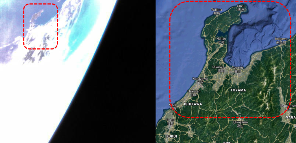
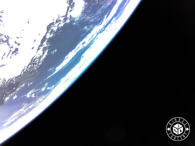
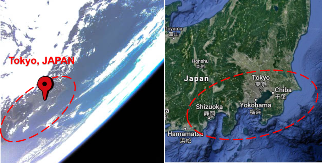
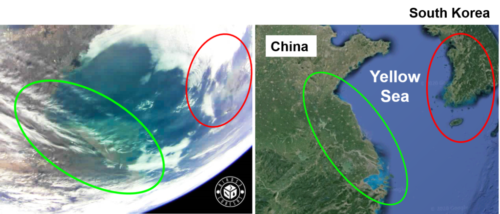
This is Japan; Honshu taken by UGUISU. This part is ISHIKAWA Prefecture and TOYAMA Prefrecture of Japan. Noto Peninsula of ISHIKAWA Prefecture is easy to find because the shape looks like a sickle, so if you find the sickle on the Honshu of Japan, that is Noto Peninsula. – Update on May 22, 2020 –Here is TOKYO, JAPAN taken by UGUISU. As you know, TOKYO is the capital of JAPAN. I am happy that I could see my home country’s capital finally by our satellite. Although the declaration of emergency has been lifted all over Japan, I hope that the number of infected people will not increase in the future. – Update on May 29, 2020 –UGUISU took this photo. Here is Western Japan.It is the sunset of Western Japan. The Sun is seen different depend on the location, but the Sun light is always same. (Actually it is not same when we think about the space weather..) – Update on June 5, 2020 –This photo was taken by BIRDS3 satellite. The coulds which are over the Earth looks like the snow on the top of the mountain. – Update on June 12, 2020 –This photo is shown China and South Korea. We can see the Yellow Sea at the center of this photo. Also the Seoul of South Korea and Shanghai of China are shown at the both sides of this photo.– Update on June 19, 2020 –
This photo was taken by NepaliSat-1. It is difficult to see, but there is Honshu of Japan.
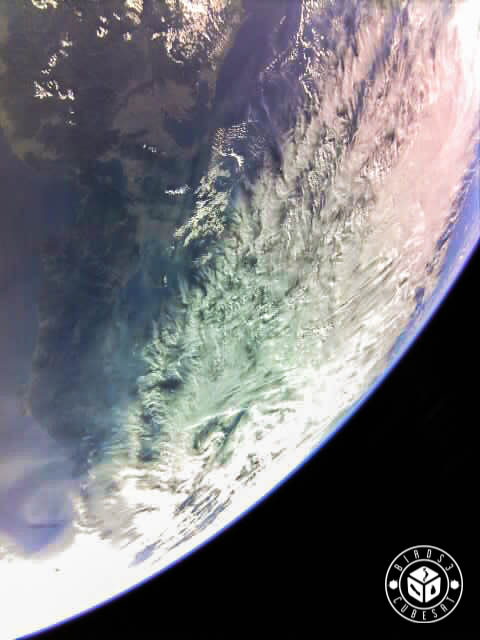
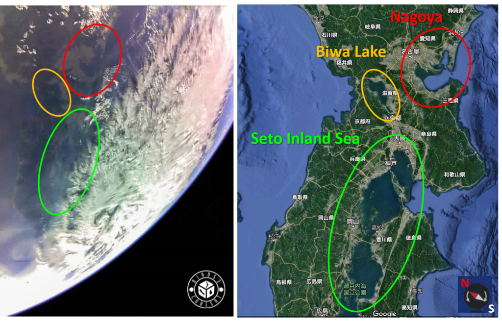
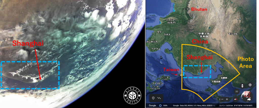
We can see Nagoya where is surrounded by red. There is also Biwa lake which is the biggest lake in Japan. Also Seto inland sea (Setonaikai) is taken in this photo. Setonaikai lies between Honshu, Shikoku and Kyushu. – Update on June 26, 2020 –We could capture the Himalayas by NepaliSat-1. We can see the snow which is on the top of Himalayas. – Update on July 4, 2020 –This photo was taken by Raavana-1. In this photo, China, Taiwan and maybe South Korea are shown.The yellow area is the photo area, and the light blue area is the place where I could find out where it is on the Earth. This light blue area included Shanghai. – Update on July 11, 2020 –This photo taken over the Japan by Uguisu. However we could not recognize where it is in Japan. Please let us know if you find the location of this photo. – Update on July 18, 2020 –
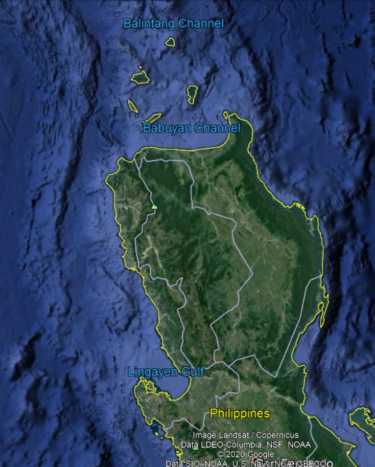
This photo which was taken by BIRDS-3 satellite is shown Philippines.
This is the North side of Philippines. – Update on July 25, 2020 –
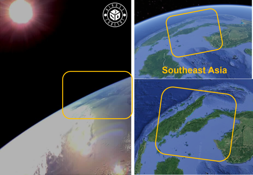
The BIRDS3 satellite took sun and the Earth. If you look carefully, you can see the part of Southeast Asia in this photo.
There are the part of the countries which are Indonesia, Singapore, Malaysia, Thailand, Myanmar, Cambodia and Vietnam. – Updated on August 2, 2020 –This photo was taken by Raavana-1. This is Sri Lanka. The Sri Lanka’s photo always looks beautiful. – Updated on August 7, 2020 –
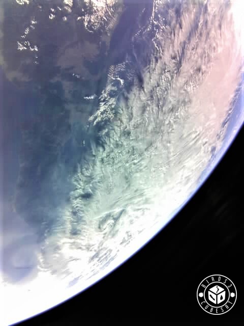
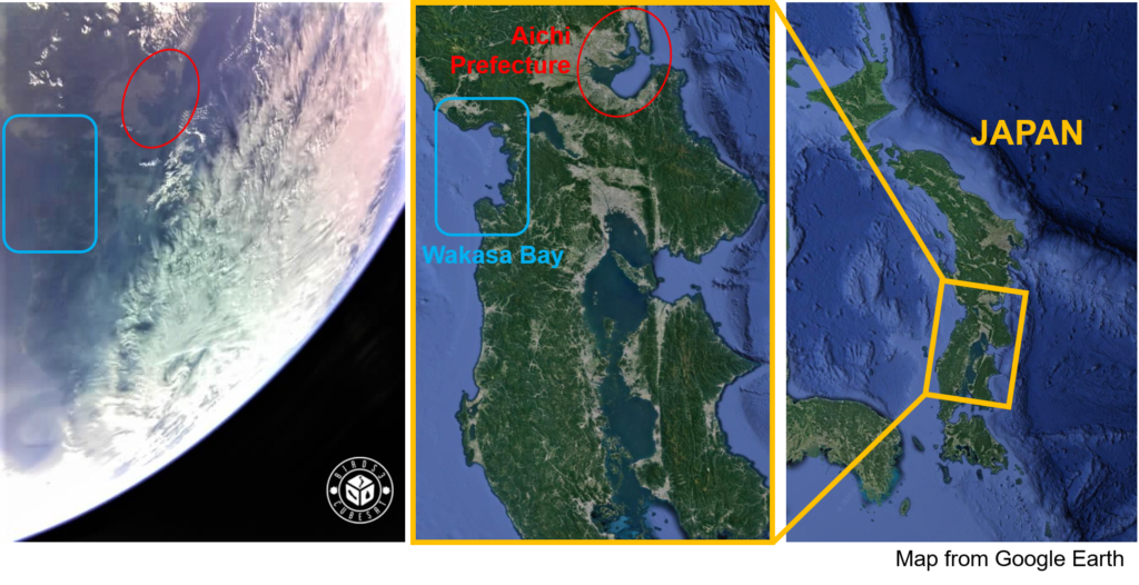
This photo was taken by Uguisu. Here is Japan.
The point that specified the location is Wakasa Bay in Fukui Prefecture. Also, you can see the Aichi Prefecture whose prefectural capital is Nagoya. – Updated on August 14, 2020 –BIRDS-3 satellite took this photo. In the summer, there are thick clouds cover over the sky. In some countries like Japan have high humidity and high temperature. Please stay healthy this summer. – Updated on August 21, 2020 –
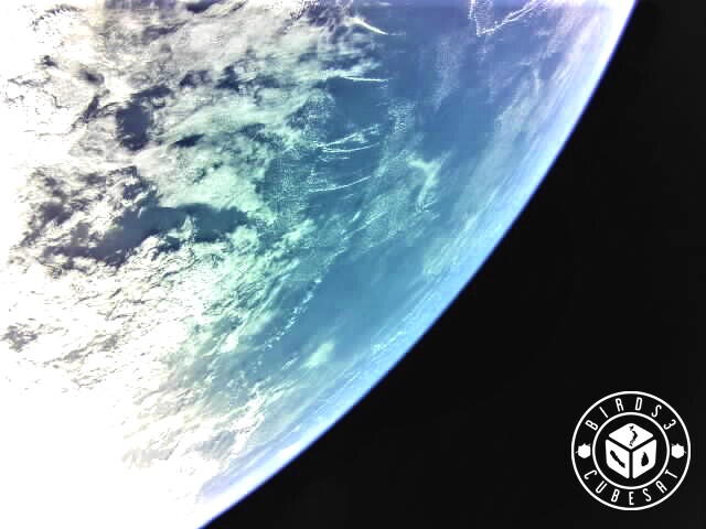
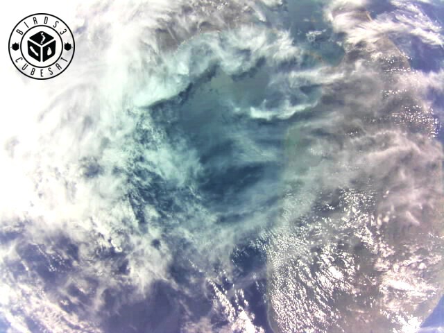
This photo was taken on August 17, 2020. I tried to find the location but it was impossible. We are thinking it is pacific ocean. – Updated on August 29, 2020 –
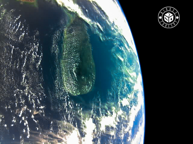
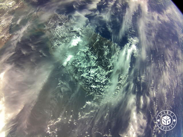
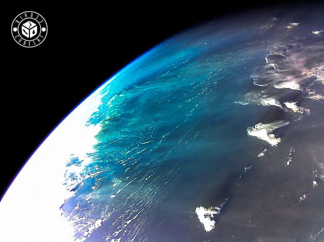
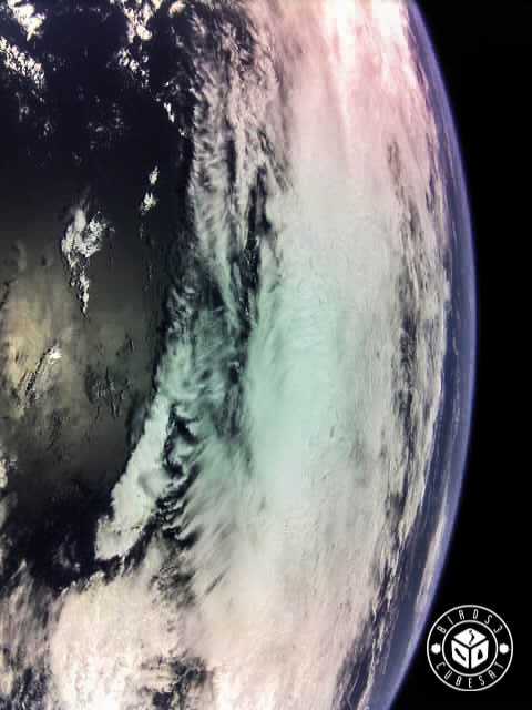
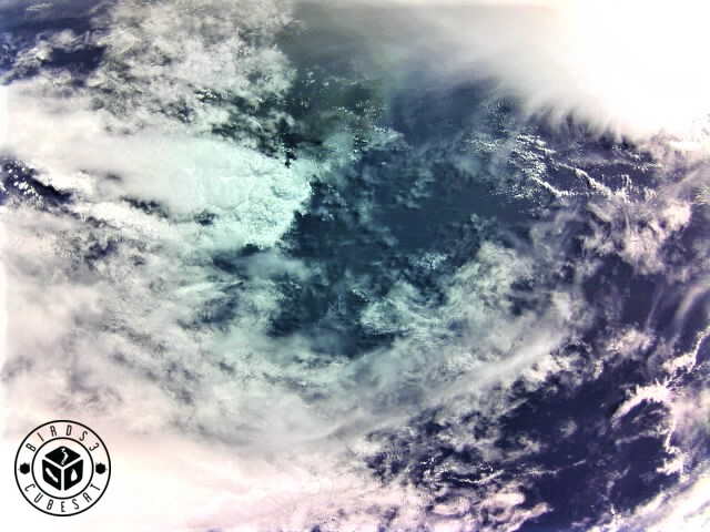
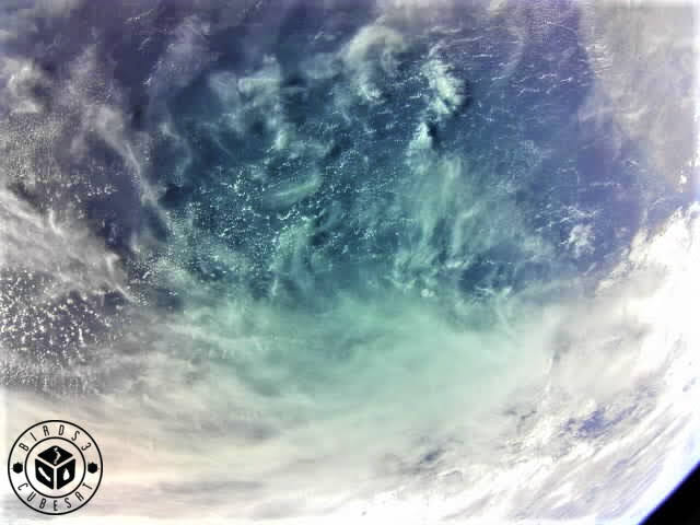
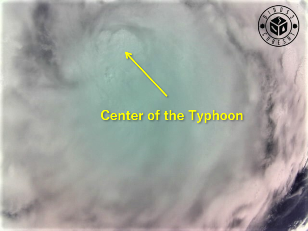
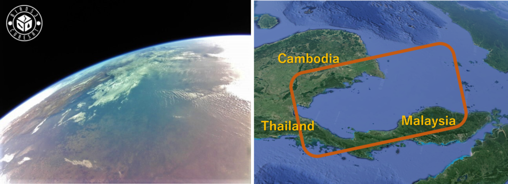
This photo was taken by Bhutan Ground Station. The area of this photo may be around China. The clouds and the ocean looks like waterfall. It is very beautiful. – Updated on September 11, 2020 – This photo was taken by Sri Lanka. This island is the part of Sri Lanka. It is the highest resolution photo in BIRDS-3 satellite. – Updated on September 20, 2020 – This is the typhoon over Japan.We can see the center of the Typhoon. – Updated on September 27, 2020 –We took the photo. It is around Southeast Asia. Cambodia, Thailand and Malaysia are in the photo. – Updated on October 3, 2020 –It is Pacific Ocean taken by BIRDS3 satellite. The cloud looks like soft snow. – Updated on October 18, 2020 –